Keywords
historical monuments, Bazaar of Tabriz, District 8, WIOA
Introduction
Our historical cities are disappearing and during the past two decades there has been an increasing formation of vast,
modern urban fabric around the historical fabric. The excessive expansion of cities, natural disasters, and
unscientific human interferences (e.g. roads, passages, and bridges that run through historical structures) has led to
irreversible damages to the historical fabric [1]. Due to the unpredictable nature of most natural disasters and the
necessity to make quick decisions and take prompt action, a new branch of knowledge has emerged which is known
as management and maintenance of historical monuments. Tabriz City, with its dense population and priceless
historic structures, is always threated by these hazards. Under these conditions, any natural or unnatural crisis will
cause irremediable damages and obviously correct management is the only way to prevent such events [2,3].
Region 8 of Tabriz is of utmost importance due to its historical fabric and its dense population. Natural disasters and
lack of proper management has caused much destruction in the historical monuments of the region. It is thus
imperative to distinguish different areas of the district in terms of their susceptibility [4]. This district is located at
the center of the city and attracts a large population on a daily basis. Hence, there is always much traffic in the
streets and thoroughfares that puts much pressure on the historical fabric of the district. Due to the rusty fabric and
dense population, any crisis in the district will clearly lead to considerable casualties and historical damage. Thus, an attempt was made in the present research to distinguish the susceptible areas of District 8 of Tabriz using GIS [5].
Pourmohammadi et al. (2006) carried out a research on the role and application of GIS in controlling and rescuing
the urban and rural residents of Tabriz. They studied the role of GIS in crisis management and rescue process before,
during, and after crisis in Tabriz [6]. Asgari and Parhizcar (2006) studied the strategies for dealing with earthquakes
and reducing the resulting damages in District 17 of Tehran. They introduced GIS as a helpful tool for crisis
management by urban planners [7]. Adhami and Maleki (2009) examined the role of GIS in crisis prevention and
management. They believe that GIS data and efficiently trained personnel can increase the efficiency of crisis
response systems [2]. Asgari and colleagues (cited in Nesyani, 2010) studied the role of urban services in managing
crises and accidents with an approach to GIS. Nesyani (2010) also applied SDSS in GIS for crisis management to
analyze District 8 of Tabriz in terms of its susceptibility to earthquakes [8].
The Studied Region
Tabriz is one of the historical cities of Iran with an area of 140 km2 located at 38°04′N 46°18′E. The mean altitude is
about 1340 meters. The historical, geographical, cultural, economic position of Tabriz has given it a special place in
the country. Meanwhile, District 8 of Tabriz, with an area of 260 hectares, constitutes the major rustic and historical
fabric of the city.
Susceptibility of Tabriz to natural disasters
The Iranian plateau is a disaster-prone area and Tabriz City is highly susceptible to natural disasters due to its
geographical structure and its special topography. Earthquake and flood are the major natural disasters that have
accompanied this ancient city throughout history, imposing much casualties and costs on the region. The historical
and ancient monuments of the city have suffered the greatest damage from such destructive earthquakes.
The natural disasters that threaten the historical monuments of cities
1. Flood
According to hydrological and meteorological studies of Tabriz, February, March, and April are the rainiest months
of the year (ZISTA Architecture & Urban Planning Consulting, 1999).
Table 1 – The flood-based disasters in Tabriz in a five-year period
2.Earthquake
Tabriz is one of the earthquake-prone regions of the country, such that earthquakes have destroyed the city several
times throughout history and have caused many casualties and many costs. One of the most destructive of
earthquakes occurred in 1721 BC in Tabriz where 250 thousand people were killed (Table 2). Considering the multimillion
population of Tabriz, any earthquake can cause dreadful casualties.
Table 2 – Destructive earthquakes in Tabriz
The historical value of the region
There are many historical monuments that have survived from different period and are scattered around the region,
including Bazaar of Tabriz, Arg (castle) of Tabriz, Congregational Mosque of Tabriz, Saheb-ol-Amr Mosque, Blue
Mosque, Maqbaratoshoara, Tabriz Museum, etc.
Materials and Methods
In the present research, library studies were carried out to identify the driving factors in locating the regions
susceptible to natural disasters. The collected parameters are as follows:
• Distance from dangerous areas such as gas stations, power lines such as water and gas, etc.
• Distance from roads and thoroughfares (minor arterial roads and local roads)
• Access to open spaces (the more the access, the less the susceptibility)
• Topography (slopes are positively associated with susceptibility)
• Distance from faults (negatively associated with susceptibility)
• Quality of the structures
• Distance from fire stations
Creating the information layers
Considering the mentioned parameters, there was a need for a land use map for the management of the historical
fabric and reduction of damages at the time of disasters. Thus, the land use map of Tabriz was acquired from the
Department of Housing and Urban Development. Then, different areas designated for specific purposes of land use
were marked out and used for extracting the required layers (figure 2). It must be noted that a map related to the
faults as well as the topography of the region were also obtained from the Department of Natural Resources.
Figure 1: The land use map of Region 8 of Tabriz
Standardization of the information layers
The first step in managing the maintenance of historical monuments at the time of crisis is to extract the required
information layers. Most of the layers of the required criteria and sub-criteria for identification of susceptible regions
are separated and valuated by creating a buffer or, in some cases, by means of Query Builder. The different layers
are drawn on the surface of the studied region and are stored in the database in the form of raster layers (which are
able to reclassify). The layers are prioritized and standardized into 3 to 6 categories based on the created buffer or
the existing applications and the final layers are as follows:
Results
Weighted index overlay analysis
Spatial analysis is done to identify the potential regions that are extracted from the values of each pixel of the raster
map based on some criteria. The weighted index overlay model enables us to combine different maps. In the present
research the multi-criteria method is used and the model is defined as (Murray, 2003): [9].
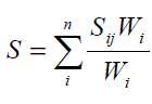
where S is the score assigned to each cell, W1 is the weight of the ith information layer, and Sij is the score of the jth
class from the ith map. In this model, each class of different layers can be assigned a particular weight and
considering the importance of each layer compared to other layers, we can assign a weight to each layer based on its
importance. This is one of the characteristics of this model in combining layers [10,11]. To obtain the output map
for the susceptible areas of Region 8 of Tabriz, the maps were classified and the potential of each of the parameters
was evaluated by the authors (table 4).
Table 3 – The weights of the evaluated criteria in the index overlay method
After standardization, the layers were imported in Weighted Overly environment in ARC GIS 9/2. After modeling
(figure 8).
Figure 8 – The final map obtained from WIOA
Discussion and Conclusion
Protection of historical monuments against natural disasters has received increasing attention over the last few
decades. Especially after recent earthquakes and other devastating natural disasters that led to destruction of
priceless historical monuments around the world, this issue has turned into a recognized and common issue. In
countries where managers of service organizations had no idea of managing the maintenance of historical
monuments for prevention, readiness, and confrontation plans, coordination between different sectors, public
training, etc., we have witnessed an increasing awareness among the people of the society in this regard. Now the
responsibility of preparing the society falls on the shoulders of administrators, planners, and experts. Tabriz is
susceptible to various hazards due to its special geographical and climatic condition and its natural structure and
most of the known natural disasters of the world have occurred in this city. Considering the history of the city with
its hundreds of priceless historical monuments, there is a greater chance of damage and costs due to hazards. Thus,
the bitter experiences of the past on the one hand and the necessity for a prompt response to different disasters that
threaten the historical fabric of the city on the other hand entails creating a system for confronting these destructive
crises.
One of the most critical regions of Tabriz, i.e. Region 8, was studied in the present research. The factors that
distinguish this region from others are as follows: the ancient monuments that has survived different historical
periods are scattered around the city, including Bazaar of Tabriz, Arg (castle) of Tabriz, Congregational Mosque of
Tabriz, Saheb-ol-Amr Mosque, Blue Mosque, Maqbaratoshoara, Tabriz Museum, etc. Another important
characteristic of the region is the presence of old residential areas. The disastrous record of this city necessitated the
adoption of strategies for classifying the susceptible parts of the region. This would enable us to take necessary
actions for preventing possible damage to the rustic and historical fabric of the city before, during, and after crisis.
Thus, the susceptibility map of the region was created using weighted index overlay method (figure 8). The results
of the output of the model indicate that only 13.94% of the studied region is in a favorable or very favorable
condition. 47.37% of the area is in an average condition in terms of susceptibility during crises. 38.69% of the area
is in an unfavorable or very unfavorable condition. Considering the studies carried out and the results related to the
layer of fire station, it must be noted that the radius of action of the closest station is between 1250-1650 meters, we
have an area in the northwest of the region that is not covered by the firefighting services. It is thus recommended
that another fire station be established in that area. It is also recommended that the instable non-historical regions be
converted to open spaces to reduce the pressure on the historical fabric and enable its repair and maintenance.
In general, since a large part of Region 8 of Tabriz lies within the average to very unfavorable spectrum, it is
necessary for the officials to implement the best strategy for protection of the historical monuments of the region
and conversion of the old, non-historical areas to open spaces as specified by the overlay map (figure 8) and thus
reduce the destructive physical pressures caused by traffic. The recommended strategies and others can prevent the
destruction of the historical fabric and the rustic residential areas of the region and therefore maintain the historical
identity of the city.
References
- M Ahadnejad, National Congress on Rustic Urban Fabrics, 2009, pp 221.
- T Ahmadi, A study of the historical fabric, 2008, pp 19-53.
- S Adhami, J Maleki, GIS and its application in prevention and management of crisis, 2009, pp68-130.
- B Beig-Babaee, Urban GIS and electronic citizens, 2007, pp 32-112.
- B Beig-Babaee, Doctorate Dissertation, IAU, 2011, pp 48.
- M.R Pourmohammadi, The role and application of GIS in management, 2006, pp 32-86.
- A Asgari, A Parhizcar, Application of urban planning methods for reduction of susceptibility to earthquake damages using GIS, 2008, pp 23-89.
- B Nesyani, Crisis management in case of earthquakes in urban areas before it occurs, 2010, pp 65.
- J Murray, A.T Ogden, P.M McDaniel, Soil Sci. 2003, 168(11): 759-768.
- S Tudes, N.D Yigiter, Preparation of land use planning model using GIS based on AHP, 2009, 235-245.
- J.J Kao, Y Lin, Multifactor spatial analysis for landfill siting,1997, 122(10): 902-908.