Review Article - (2025) Volume 13, Issue 1
Basin Analysis and Integrated Reservoir Modeling for Petroleum Development and Production, Bida North Central Along the Niger Valley, Nigeria
Joshua C. Odinkemere*
Department of Computer Science and Technology, Novena University, Delta, Nigeria
*Correspondence:
Joshua C. Odinkemere, Department of Computer Science and Technology, Novena University, Delta,
Nigeria,
Email:
Received: 01-Mar-2024, Manuscript No. IPACSES-24-19116;
Editor assigned: 04-Mar-2024, Pre QC No. IPACSES-24-19116 (PQ);
Reviewed: 18-Mar-2024, QC No. IPACSES-24-19116;
Revised: 11-Feb-2025, Manuscript No. IPACSES-24-19116 (R);
Published:
18-Feb-2025, DOI: 10.36648/2349-7238.25.13.36
Abstract
Sedimentology, paleontology and well log investigations were carried out on shale samples derived from the sedimentary basin and reservoir in Bida North Central along the Niger valley Nigeria. Various dynamic events such as multiphase fluids flow, Kerogen, maturation kinetic and sediment deposition, faulting can be applied for basin and reservoir modeling at diverse stages utilizing 2D method to reconstruct hydrocarbon development, migration, accumulation and production across a geologic bed. These investigations aimed at analyzing the petroleum development and production of Bida North Central along Niger valley, Nigeria. The result of strategraphic sequence indicates that initial basin. Fill is comprised of largely complex and stacked fanglomerate system formed from various saimple stream breaches onto the proximal structure of the basin. The fanglomerates, an alluvian fan directly overly the basin and reveals a fining upward sequence. It further indicated the Bida sandstone; it further indicated the Bida sandstone overlain directly by oolitic/pisolitic ironstone of Sakpe ironstone succeeded by a sequence of rocks known as Enagi formation, characterized mainly of fine to medium-grained-medium-grained-grey clay carbonaceous silts and prevalent concretionary ironstone bands. Well log results aided in the actualization of accurate reservoir quality and provenance of the rock samples tested and the identification of basin characteristics at the exploration stages.
Keywords
Strategraphic sequence; Paleontology; Well log; Bida basin; Hydrocarbon
Introduction
Prospects at the inland basins had been hitherto unactualized economically due to inadequate information of lithology and structural arrangements. The inland basins in Nigeria is made of up of Anambra basin and the Dahamey basins in the south, the lower, middle and upper Benue Trough, the Chad (Bornu) basin in the N.E, the Bida basin and the Sokoto basin in the N.W [1]. The Bida basin is located at the West-Central Nigeria and is also known as Nupe or mid-Niger basin.
Reservoir modeling entails certain well characterization that aids in the determination of reservoir characteristics of such as porosity, volume and permeability. Basin analysis and reservoir modeling is usually applied in hydrocarbon prospects for development and production.
Reservoir modeling consists of techniques for hydrocarbon exploration for the characterization of reservoir qualities for petroleum development and production. They are often utilized in building, monitoring and prospects of basin. Infill’s or hydrocarbon reservoirs, pools, which may either, be laterally or vertically offset from developed areas of both green and brown fields (Figure 1).

Figure 1: Hydrocarbon reservoir in the study area.
Strategraphic succession was needed to provide information on the geological arrangements of the basin in Bida North Central valley, Niger state. Commercial hydrocarbon accumulations have recently been discovered in Chad, development of the Doba discovery with estimated reserves of about 1 billion barrels has resulted in the construction of a 1070 km long pipeline to the Atlantic coast (Figure 2) [2].
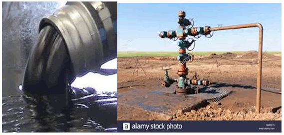
Figure 2: Petroleum well derived from the study area.
These findings have encouraged geological, geophysical and other exploration investigations in the inland basins.
This tends to ascertain the sedimentology, paleontology and geochemical well log assessment of the Bida basin and reservoir, North central, along the Niger valley, Nigeria; and infer their hydrocarbon resource potentials of the basin (Figure 3).
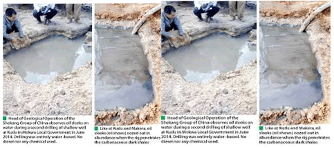
Figure 3: Hydrocarbon reservoir derived from the studied area.
The strategraphic sequence, paleontology and well log studies were needed to provide quantitative information on the distribution of geological facies, porosities and permeability’s for reservoir modelling building well planning, geo-steering and reservoir management (Figure 4).

Figure 4: Exploration activities of hydrocarbon deposits in the study area by NNPCL group.
Lithologies in the study area consists of shales and sands which are heterogeneous due to deep water setting which geologic past was conducive for successive sedimentation, alluvial and fluvial erosional episodes and tectonics.
Literature Review
The strategraphy and sedimentation of upper cretaceous succession of the Bida basin were documented by Adeleye and Dessauvagia in the central parts of the basin around Bida, the study area. The study defined and created the mappable lithostrategraphic units that are correctly been used for Bida basin. The interpretation of Landsat imagerries and borehole logs as well as geophysical data Ojo, suggested that basin is bounded by a system of linear faults trending, NW- SE, while the gravity stidies of Ojo and Ajakaiye point to a series of central positive anomalies flanked by negative anomalies, similar to the adjacent Benue trough and typical of rift structures. These works generally corroborate the interpretations of Ojo and Ajakaiye that outlined the basin as being bounded by system of linear faults.
Geology Setting of the Study Area
The Bida basin is intracratonic structure extending from Kontogora in Niger state in the north central of Nigeria; from the southern part of the study area-Lokoja. It tends perpendicularly to the main axis of the benue trough of the Niger Delta basin in the late cretaceous stage of the sequence. The investigation area merges at Anambra and Sokoto basin at the SE and NW of the area. The Bida basin was formed as a simple sag structure in response to Santonian fding in the Benue trough (Figure 5) [3].
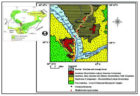
Figure 5: Geologic map of studied area, with insert of Nigerian map showing NW/SE trending Bida basin.
The basin evolved from a gift that created as Abakaliki Benue fold belt developed in response to tectonic pulse arising from the collision between West-African plate and central Africa between 85 Ma and 80 Ma. The study area is NW-SE trending inland basin, stretching from Shegwa (NW) to Dekina (SE). It is approximately 350 km long and varies in width from 75 to 150 km. The Sedimentary fill of the Benue Trough consists of three unconformity-bounded depositional sequences; and the Bida and Anambra regions were platforms until the Santonian rock are recorded in parts of the older Benue trough and in the Southern Anambra basin [4].
Location and accessibility: The geological setting of the Bida basin shows that it is situated between the Precambrian northern Nigeria massif and the West African carton. This is delimited in the North East by the basement complex and south west by west African Craton [5].
A geological traverse covering the entire basin was undertaken by the authors paying particular attention to the South Bida basin where sections are better exposed and more accessible [6]. The study area is located in the West-central Nigeria inland basins and are comprised the Anambra and Dahomey basin in the South, the lower middle and upper Benue trough, the Chad (Borno) basin in the North West. As a result of their geology and distance, exploration activities of the inland basin have not been commercially successful to date [7]. It contains one set of a series of a Cretaceous and later rift basins in central and West Africa whose origin is related to the opening of the South Atlantic. The rift trend the Chad, Sudan, Niger had recorded the presence/accumulation of petroleum in the area.
Sieve Pipet Analysis
This measures the mass the percentage for the defined grain size classes. Stokes' law assumes that the particles are rigid, smooth sphere, rather than the plate-like shape of many clay particles, the results are expressed as equivalent spherical diameter.
10 ml pipette samples of rocks strata were derived from outcrop of proven rocks in the study area and were tested in the stack. The sieve was shaken for about 5-10 minutes. The residues were weighed in the pan and calculate the percentage in the starting weight [8].
Sedimentology is tied to stratigraphy which studies the relationships between rock layers and how they can shift and move. This also affects where petroleum deposits can be found, as well as how the extraction of petroleum affects the sediment around the sediment [9].
Paleontology-Argon-Potassium
Rock samples derived from the four locations at the study area were grinded and crystal of mineral fragments of rock samples was analyzed. Rock samples were then irradiated to produce 39Ar from 39K through the (n-p) reactions 39K (n,p) 39Ar. The samples were then degassed in high vacuum mass spectrometer via a laser or resistance furnace upon the disintegration of radioactive potassium-40 to radioactive potassium-40 to radioactive argon in minerals and rocks; potassium-40 also decays to calcium-40. Thus, the ratio argon-40 and pottassium-40 and radiogenic calcium-40, to potassium-40 in a mineral or rocks is a measure of the age the sample half-life, i.e., the rate of decay is then calculated to assess the age of the sample and the amount of the accumulation of Argon in the mineral rock samples were determined [10].
Methodology Geochemical Analysis
In this study, Rock Eval Pyrolysis (REP) is an analysis of hydrocarbon components in source rock by means of gradual heating of the source rock samples, in an oxygen free state where the programmers temperature insert (Table 1). From the heating, the solid separates free organic components that are still bound in the host rock. The results of the REP analysis are populated with several Parameters, namely the values of S1, S2, S3, Tmax and combination, namely PY, PI and H1.
| Well name |
Depth (Ft) |
S1 (MgHc/gRk) |
S2 (MgH) |
S3 (MgCO2) |
Tmax (°C) |
PY |
PI |
HI (MgHc/g TOc) |
| BD-1 |
2000 |
4.24 |
2.22 |
1.29 |
364 |
2115.3 |
0.899 |
339.68 |
| EG-1 |
4000 |
0.029 |
0.629 |
0.739 |
436 |
0.766 |
0.0438 |
130.69 |
| LE-1 |
- |
- |
- |
- |
- |
- |
- |
- |
| MO-1 |
5800 |
0.3 |
2.24 |
- |
430 |
2.53 |
0.0824 |
128.17 |
| KA-1 |
7800 |
0.08 |
1.63 |
- |
436 |
1.8 |
0.0413 |
207.43 |
Table 1: Result of REP analysis on samples derived from the study area.
Geochemical well logging methodology is an evaluation of its usefulness as a quick scan of potential source rock, but also in its ability to identify the organic richness (TOC %) of these rocks.
Results and Discussion
Paleontology and Sedimentology
The results of the stratigraphic sequence indicates that initial basin is comprised of largely complex and stack fanglomerates system formed from various simple stream breaches into the proximal structure of the basin. The fanglomerates directly overly the basement complex and reveals a fining upward sequence [11]. Furthermore, indicated the Bida sandstone overlain directly by Pisolitic/oolitic ironstone of the Sakpe stone succeeded by a sequence of rocks known as Enagi formation, characterized mainly of fine to medium to grained to grey to white sandstone to grey clay's, to carbonaceous silt and shales and prevalent concretionary ironstone well log results aided in the actualization accurate reservoir quality and provenance of rock samples tested and the identification characteristics at exploration stage (Figure 6).
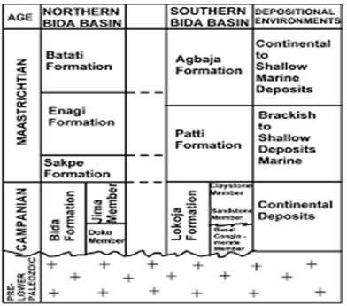
Figure 6: Tabular representation of stratigraphic/sedimentology sequence of the Bida Basin.
Results of Geochemical Well Log Assessment of the Study Area
Formations in Bida basin: Bida sandstone, Sakpe ironstone, Enagi Siltstone and Patti ironstone. These correlate with Lokoja formation in the Southern Bida basin. The Enagi siltstone is a potential zone for natural gas generation. As a result of high percentage of Total Organic Carbon (TOC) of rock samples in the study area, making it potential formation/ source rock for hydrocarbon generation; and because of their standard Vitrinite Reflectance (Ro) (Ohm. M)-EG-1-(0.21); (Enagi Sat); Mo-1-(0.31); (Mokwa formation) (Table 2 and Figures 7 and 8) [12,13].
| Well name |
Depth Ft |
Ro |
| BD-1 |
2000 |
0.67 |
| EG-1 |
4000 |
0.21 |
| LE-1 |
- |
- |
| MO-1 |
5800 |
0.31 |
| KA-1 |
7800 |
0.41 |
Table 2: Ro (Vitrinite Reflectance) values of shale samples in the area.
Figure 7 of Rock Eval Pyrosis (REP) on five reservoirs in the study area.

Figure 7: Graph of REP on five wells in the study area; depth (Ft)/Permeability Index (PI).
Figure 8 of Vitrinites Reflectance (Ro) Ohms. M of the samples derived from the study area.

Figure 8: Graph of Vitrinites Reflectance (Ro) Ohm.M on five reservoirs in the study area.
Conclusion
Geochemical well logging, sedimentology and paleontology investigations were carried out on shale samples derived from the sedimentary inland basins of Bida North Central along the Niger valley, Niger state, Nigeria; to ascertain the petroleum development and production of the reservoir basin in the study area.
Formations in Bida basin: Bida sandstone, Sakpe Ironstone, Enagi Siltstone and Patti ironstone. These correlate with Lokoja formation in the Southern Bida basin. The Enagi siltstone is a potential zone for natural gas generation/ accumulation while the bida sandstone is a potential reservoir for petroleum accumulation as a result of carbonate rock formations in the area, which exhibit highly varying properties of porosity, permeability and flow mechanism from the reservoir qualities indicating it a potential zone for petroleum accumulation in the study area.
Geochemical studies in the area of assessment show that the Patti formation is source rock for hydrocarbon production and development at the bida basin as a result of high Total Organic Carbon (TOC) percentage of the rock samples in the area, making it potential formation/source rock for hydrocarbon generation. Thus, petroleum development and production in the study area, is possible at the prospectively stage and could surpass when serious exploration activities are carried out in the area; which could engender outright exploitation of the product in the area for economic qualities.
Recommendation
• Thorough exploration activities should be carried out on the study area, to ascertain the magnitude of hydrocarbon accumulation, migration and generation in order to ensure effective exploitation processes at the Bida basin and the environs.
• Intensive prospects for natural gas accumulation should be carried out at the Enagi siltstone at the study area, because of the occurrence of carbonate rocks in the area with varying reservoir qualities of porosity, permeability, saturation, migration which are essential for natural gas generation, accumulation and migration.
Acknowledgement
Many thanks to all and sundry that saw to the accomplishment of this study. Thanks to the residents of the study area for their yieldedness to the questionnaires and survey. And to all who made this study a worthwhile for their immense impacts. Thank you all!
References
- Abimbola AF (1997) Petrographic and paragenetic studies of the Agbaja ironstone formation, Nupe Basin, Nigeria. J Afr Earth Sci. 25(2):169-181.
[Google Scholar]
- Adeleye DR (1974) Sedimentology of the fluvial bida sandstone (cretaceous), Nigeria. Sediment Geol. 12(1):1-24.
[Google Scholar]
- Adeniyi JO (1985) Ground total magnetic intensity in parts of the Nupe Basin and the adjacent basement complex, Niger State, Nigeria. Niger J App Sci. 3:67-78.
- Akande SO, Ojo OJ, Erdtmann BD, Hetenyi M (2005) Paleoenvironments organic petrology and Rock-Eval studies on source rock facies of the Lower Maastrichtian Patti Formation, southern Bida Basin, Nigeria. J Afr Earth Sci. 41(5):394-406.
[Google Scholar]
- Braide SP (1992) Syntectonic fluvial sedimentation in the central Bida Basin. J Mining Geo. 1992;28(1):55-63.
- Obaje NG, Musa MK, Odoma AN, Hamza H (2011) The Bida Basin in North-central Nigeria: sedimentology and petroleum geology. J Pet Gas Exploration Res. 1(1):1-13.
- Baldwin B, Butler CO (1985) Compaction curves. AAPG Bull. 69(4):622-626.
[Google Scholar]
- Bear J (2013) Dynamics of fluids in porous media. Courier Corporation.
[Google Scholar]
- Lambe TW (1951) Soil testing for engineers. LWW. 72(5):406.
[Google Scholar]
- Pryor WA (1973) Permeability-porosity patterns and variations in some Holocene sand bodies. AAPG Bull. 57(1):162-189.
[Google Scholar]
- Nelson PA (1994) Permeability-Porosity relationship patterns and variations in some Holocene Sand bodies: American association of petroleum geologists. Bulletin. 57(1):162-189.
- Pumpelly R, Woff JE, Dale TN (1894) Geology of the green mountains, Part III, Mount grey lock: Its areal and structural geology. US Geological Survey Mon. 22:158.
- Nopiyanti T, Nainggolan TB, Dewato O, Haq DA (2020) Well log analysis and geochemical data to identify source rock and hydrocarbon reservoir: Northeast Java Basin study case. InAIP Conference Proceedings 2020;2245(1).
[Google Scholar]
Citation: Odinkemere JC (2025) Basin Analysis and Integrated Reservoir Modeling for Petroleum Development and Production,
Bida North Central Along the Niger Valley, Nigeria. Am J Comp Science Eng Surv. 13.36.
Copyright: © 2025 Odinkemere JC. This is an open-access article distributed under the terms of the Creative Commons
Attribution License, which permits unrestricted use, distribution and reproduction in any medium, provided the original author
and source are credited.


